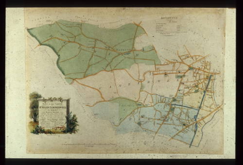
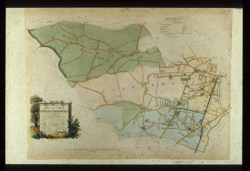
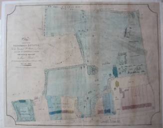
Plan of the Parish of St Giles, 1834
Date1837
MediumMap
DimensionsObject/Work: 355 x 488 mm
ClassificationsArtworks/Commemorations/Photographs
Terms
Object numberGA0328
DescriptionMade in 1837 and drawn by Poole, Second Clerk to the Board of Guardians of St. Giles Camberwell, this map is a second corrected edition. The first was made in 1834 following the perambulation to check the boundary. Unlike commercially produced maps it is orientated east to west rather than north to south. It clearly shows the Grand Surrey Canal passing through Walworth Road and Peckham, now filled in and used as a footpath and cycle way.
On View
Not on viewCollections


1900-1914
1200-1500


E. Calcott
John Arthur Poulter