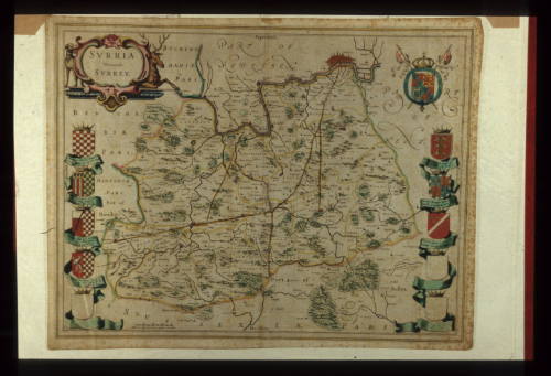
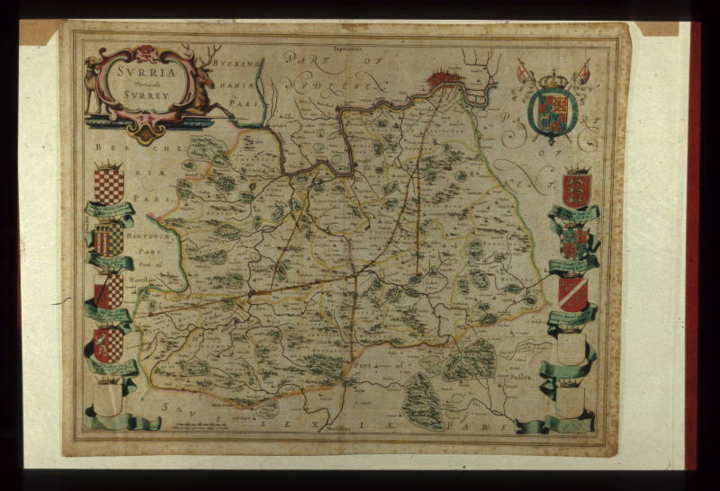
Map of Surrey
Date1645
MediumMap
Medium 2: Colour wash
DimensionsObject/Work: 380 x 490 mm
ClassificationsArtworks/Commemorations/Photographs
Terms
Object numberGA1325
DescriptionVerso, Contemporary French text. Leaf from Atlas of England, Scotland, Wales and Ireland. Begun by Cartographer Willem Jansloon Blaeu and published after his death by his son. Produced on the Blaeu's own press at Bloemgracht, Amsterdam. You can see, all the major roads from the south coast ports of Folkestone and Dover which then pass through the farms of east Surrey and Kent. All the roads then pass through Camberwell, Peckham and Bermondsey to join at the single Thames crossing at London Bridge.
On View
Not on viewCollections


1875-1899